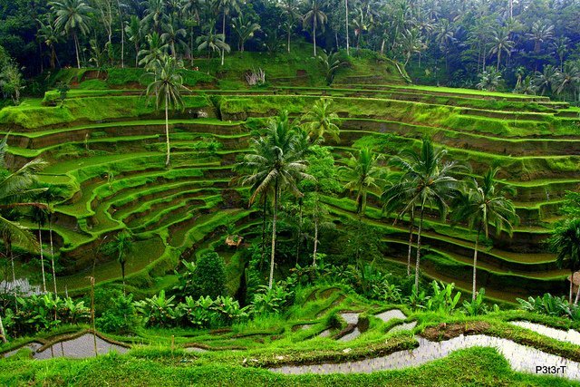
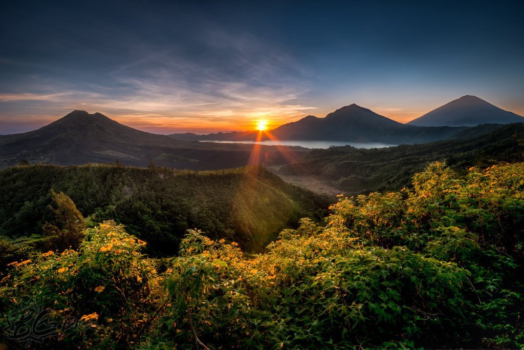
Based on Geographical Information that Bali Island is one of the provinces in Indonesia and this province is located between Java Island and Lombok Island. The frame area of this island is from the north that is surrounded by Bali Sea (Laut Bali), in the east limited by Lombok Strait, in the south limited by Indian Ocean and in the west is limited by Bali Strait. Bali Province is consisted of Bali Island, Nusa Penida Island, Nusa Lembongan Island, Nusa Ceningan Island and Menjangan Island and it is thorough out about 5.632,86 kilometers square. Base on the administration, Bali is consisted of 8 districts, 53 sub districts, and 674 villages.
Other Views of Bali Island
Bali Island is a strategic area because this area it is connecting the transportation between Java and other islands in east of Bali Island (Nusa Tenggara). Bali is also located between Asia and Australia . Geographically in the center of Bali , some mount spread out on this island like Agung Mount (3.142 meters) Gunung Batur (1.717 meters), Abang Mount (2.152 meters) and Batukaru Mount (2.276 meters). Beside of mountain, Bali also has some lakes like Batur Lake (1.605 Ha), Beratan Lake (375,6 Ha), Buyan Lake (336 Ha) and Tamblingan Lake(110 Ha). Bali Island is a tropic area that is influenced by two seasons a year that is Dry Season and Wet Season. The temperature is about 24,0° C – 30,8° C and the humidity is about 79%. That are the Bali geographical information.
Another Services
MEETINGS and CONFERENCES
- Meeting and Conference in Bali and furthermore
- Incentive group meeting and furthermore
- IMF Meeting and furthermore
- Asahi Intec Meeting and furthermore
- Sport Event and furthermore
- Incentive Group Program and furthermore
- Meeting and Tours and furthermore
- Incentive group activities and furthermore
- Group leisure activities and furthermore
STUDENT TRIPS AND REFERENCE
- Student trip and furthermore
- Balinese culture lesson and furthermore
- Farming activities and furthermore
- Medan Independent school and furthermore
- Surabaya Interculture school and furthermore
- CAIS Hongkong and furthermore
- German-Swiss school Hongkong and furthermore
- Fairview International school and furthermore
- Stamford International school and furthermore
- ACSI Singapore and furthermore
OUTDOOR TEAM BUILDING
- Outdoor teambuilding and furthermore
- Teambuilding fun game and furthermore
- Beach teambuilding and furthermore
- Garden teambuilding and furthermore
- Rafting teambuilding and furthermore
- Treasure Hunt and furthermore
- Bali fun rally and furthermore
- Muddy land activities and furthermore
- Raft building race and furthermore
- Canoe fun race and furthermore
- Treetop teambuilding and furthermore
- Cooking competition and furthermore
Bali event organizer Services and Products
Event and CSR Program
Group Tour
- Group tour arrangement and furthermore
- Tanah Lot tour and furthermore
- Denpasar city tour and furthermore
- Uluwatu sunset tour and furthermore
- Ubud tour and furthermore
- Bedugul tour and furthermore
- Kintamani tour and furthermore
- Besakih temple tour and furthermore
- Karangasem tour and furthermore
- West National Park tour and furthermore
- Singaraja Lovina tour and furthermore
Group Adventure
- Adventure for incentive group and furthermore
- Experience group cycling and furthermore
- AT Kerney group and furthermore
- DHL group and furthermore
- Transport arrangement and furthermore
- VIP airport service and furthermore
- Air ticket for group and furthermore
- Souvenir gift and furthermore
- Exhibition service assistant and furthermore
Student Trip and CSR program, instead of Bali Island geographical information
Bali’s Information
- Travel tips and furthermore
- Map of Bali and furthermore
- Foreign Consulate and furthermore
- Emergency aids and furthermore
- Indonesian embassy office and furthermore
- Bars restaurant and furthermore
- Shopping places and furthermore
- What new in Bali and furthermore
- General information and furthermore
- Geographic and furthermore
- Balinese people and furthermore
- Culture, religion and furthermore
- Etiquette and furthermore
- Tri Hita Karana and furthermore
Company and Group Reference
- Singapore software company and furthermore
- Edenred Pte Ltd and furthermore
- Jacqui Terrance and furthermore
- Lalalmove company and furthermore
- Smiths Detection and furthermore
- AB Food Thailand and furthermore
- Egon Zehnder and furthermore
- Telkom HCOW and furthermore
- Weebs Mandiri and furthermore
- Google Pay Asia and furthermore
- SimCorp Group and furthermore
- Deutsche Bank and furthermore
- Mastercard Asia and furthermore
Company’s Information
- Company Profile and furthermore
- The team and furthermore
- Business location and furthermore
- Company Association and furthermore
- Event policy and furthermore
- Products services and furthermore
- Event Gallery and furthermore
- Contact us and furthermore
- Event Q & A and furthermore
- Home Bali Group Organizer and furthermore
- Group reference on 2019 and furthermore
- Group reference on 2018 and furthermore
- Reference of group on 2017 and furthermore
- Group reference on 2016 and furthermore
- Group reference on 2015 and furthermore


